Head in the clouds: Hiking Nong Khiaw Viewpoint (Pha Daeng Peak) in Laos
Interested in hiking Nong Khiaw viewpoint in Laos? Wondering if you need Mount Everest level climbing skills? (Hint: you don’t). Here’s everything you need to know.
The alarm goes off at 4:15am and unusually for me, I am up like a flash. My sister would be proud as I am not a morning person at all and on most days I am tempted to keep hitting the 'snooze' button.
However, there was a good reason for waking up at this ungodly hour: to climb up to Nong Khiaw viewpoint (also known as Pha Daeng peak), which offers 360-degree views of the mountains and the river in this small rural village.
So there we were, changing into our walking gear and pepping ourselves up with tea and coffee (lucky for us there was a kettle in the room) before heading out into the darkness at around 4:45am to find the start of the trail to the viewpoint. At this point it was actually still dark and I did begin to wonder whether the torch on my phone would be suitable for the hike up to Pha Daeng Peak. #badplanning
How I feel about early mornings.
We decided to do this hike in the morning to beat the ungodly heat of the Laotion summer (pretty much a stifling 35 plus degrees every day unless it has been raining) and also to see if we could catch some pretty views in the early morning light of the day. We weren't doing it early to catch the sunrise (which for the record on that day was around 5:44am) because that would mean getting up even earlier and therefore requires way more dedication than either for us have.
Looking for more trekking in Laos? Check out this guide to trekking in Luang Namtha in Northern Laos.
A lot of people also hike up to the viewpoint for sunset (starting at around 4:00pm) but the idea of coming back down the side of a mountain in the darkness, with only our phone torches lighting the way was a no-go for Vincent. Possibly the result of too many bad experiences on previous hikes with me.
Looking slightly sheepish after having to hike back down a mountain in the dark in South Korea.
As we left our guesthouse we were unsurprised to see that the village around was already a hive of activity, with some people walking around exercising and others setting up their stalls for the morning market. No one batted an eyelid to see that we were up and about. Laotians get up hella early.
How to Get to Nong Khiaw Viewpoint (aka Pha Daeng Peak)
Our walk to the start of the hike took us just under half an hour as our guesthouse, Nam Ou View Villa, was on the other side of town. So basically that means for most people who stay closer to town, you can stay in bed for at least an extra 15 minutes. The trailhead is actually a short walk after the bridge on the east side of the town - a little bit further on from Canthalideth restaurant (that I kept mispronouncing as Canthali-death) and about three minutes walk from the Viewpoint Resort (nice cashing in there guys!).
The entrance to the trail is well marked with a huge wooden sign that says 'Viewpoint’ at the roadside and a map showing the route to Pha Daeng Peak. Further down the path were other signs warning you about unexploded bombs still being in the area.
Yep, we missed this.
Hilariously, we managed to completely miss all these signs in the darkness and only spotted them on the way back down. Another #fail. However, as a result of our visit to the COPE centre in Vientiane we were well informed about Laos' terrible history of being the most bombed country in the world as a consequence of the Vietnam war and the danger that the 80 million remaining UXOs (Unexploded Ordinance) continue to present to the local population. So we made sure that we stuck to the designated hiking path as we slowly but carefully made our way up the trail.
Nope. Didn’t see this one either.
Behind the sign is a ticket office (again only clearly visible in daylight), which I assume is manned during regular hours and a house which is where I think the ticket collecting family reside. As we walked up and continued on along the trail (wondering out loud where on earth we could buy a ticket to the viewpoint at this God-Awful hour) we suddenly heard a whispered "Sabaidee" in the darkness and turned around to see a woman behind us. The ticket collector was also awake! We duly paid our viewpoint entrance fee of 20,000kip each and then continued on our way.
The Experience: Hiking Up to Pha Daeng Peak
Signs at the beginning of the trail indicate that the climb up to the viewpoint could take between 1 to 1.5 hours and 45 minutes to go back down. This all depends on the weather though - if it has been raining, the trail will be muddy and extremely slippery and so the climb up can take much longer, up to 2 hours or more depending on your level of fitness.
Another sign that we missed, but it has some useful information on it.
Luckily for us, the day before had been nice and dry and so although still slightly muddy and steep, the uphill climb took us just over an hour. The trail is very well maintained and even in the darkness (lit only with my crappy flashlight) was really easy to follow, so there isn’t a chance of you getting lost.
Mostly the path consisted of a hard packed dirt trail that cut through the jungle and that just basically…kept getting steeper. There were some parts of the trail that also had some ropes for extra assistance, particularly on the steeper sections. We wore trainers for the hike although most local people seemed to do the trek in flip flops (there is a level of skill involved in this that I just don’t understand).
For more jungle trekking and cultural experiences in Laos, read this post on how we visited the Akha tribe on a jungle trek in Northern Laos.
The hike through the jungle was, despite the early morning hours, still a sweat drenched one. As the sky began to lighten, I caught a glimpse of some of the views through the trees and began to realise how high up we already were.
We came across a sign about half an hour into our walk that told us that we were now halfway. Depending on how difficult you are finding the climb, I guess that could make you feel either elated or totally demoralised!
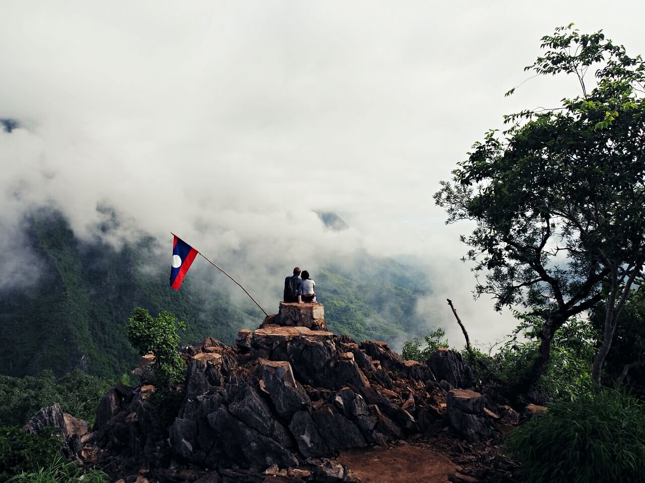
After an hour or so of sweating, we finally reached the top and we were greeted by this:
Erm…
Oh. Evidently no one had told the clouds that we would be climbing Pha Daeng Peak mega-early so could they politely, just you know, do one? Nope, these thick and beautifully fluffy clouds obscured absolutely everything. I just about caught a glimpse of a jagged tree covered peak and then it was gone.
Now you see it…
…and now you don’t
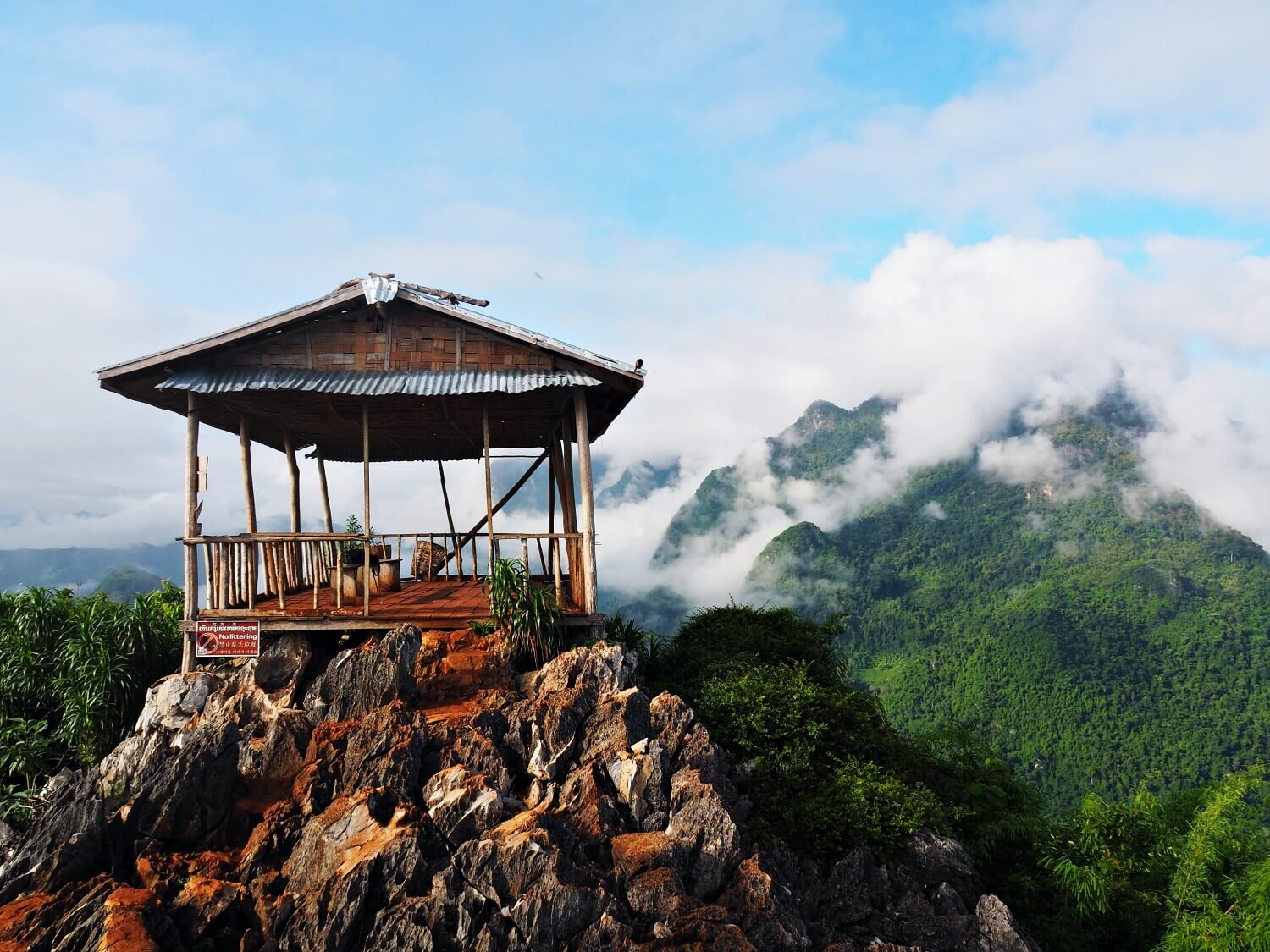
Sitting down under the covered platform that usually offers 360-degree views of the area below the viewpoint (currently all white and cloudy), I did a quick Google search: ‘clouds at Pha Daeng peak viewpoint’ and was dismayed to discover that sometimes the cloud cover didn’t disperse until after 10:00am! I duly relayed this information to Vincent and he looked incredulous - surely I wasn’t suggesting that we wait until then for the clouds to clear?! I looked at my phone - it was now 6:30am so that would mean waiting for over three and a half hours. My stomach was already grumbling and dreaming of breakfast. Did I really want to wait for that long?
Vincent looking up what to do at a cloudy viewpoint.
Well yeah, I kind of did. I’d made the bloody effort to wake up early to climb this damn peak, so I was as sure as hell going to wait until I saw some kind of view. Plus we were the only ones up there, so I figured we might as well wait while we had the place to ourselves. Vincent saw the grim look of resolution and recognising what it meant, settled down to wait.
I applied some insect repellent to my arms to ward off the voracious mosquitos and then, just so I could feel like the time wasn’t being completely wasted, started writing down some thoughts for this blog post. Vincent suggested that we do a ten-minute guided meditation while we waited, so we played something on YouTube, lay down and got our zen on. It was beautifully quiet and still, so why not? I can’t think of many better places to meditate!
Let the waiting games begin!
Eventually the cloud cover started coming in closer and suddenly the little hut we were sheltering under was filled with mist and water vapour. Inexplicably, for someone who had just sweated buckets, I started to get a bit chilly. I put on the extra T-shirt that Vincent had brought along with him and then we started jogging around and shadow boxing to keep warm. This was all beginning to feel a little surreal.
Vincent in meditation mode.
And then Vincent said, “Wow, look!”
Surprise! But were these views here to stay?
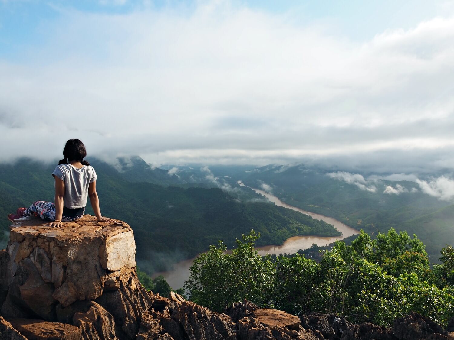
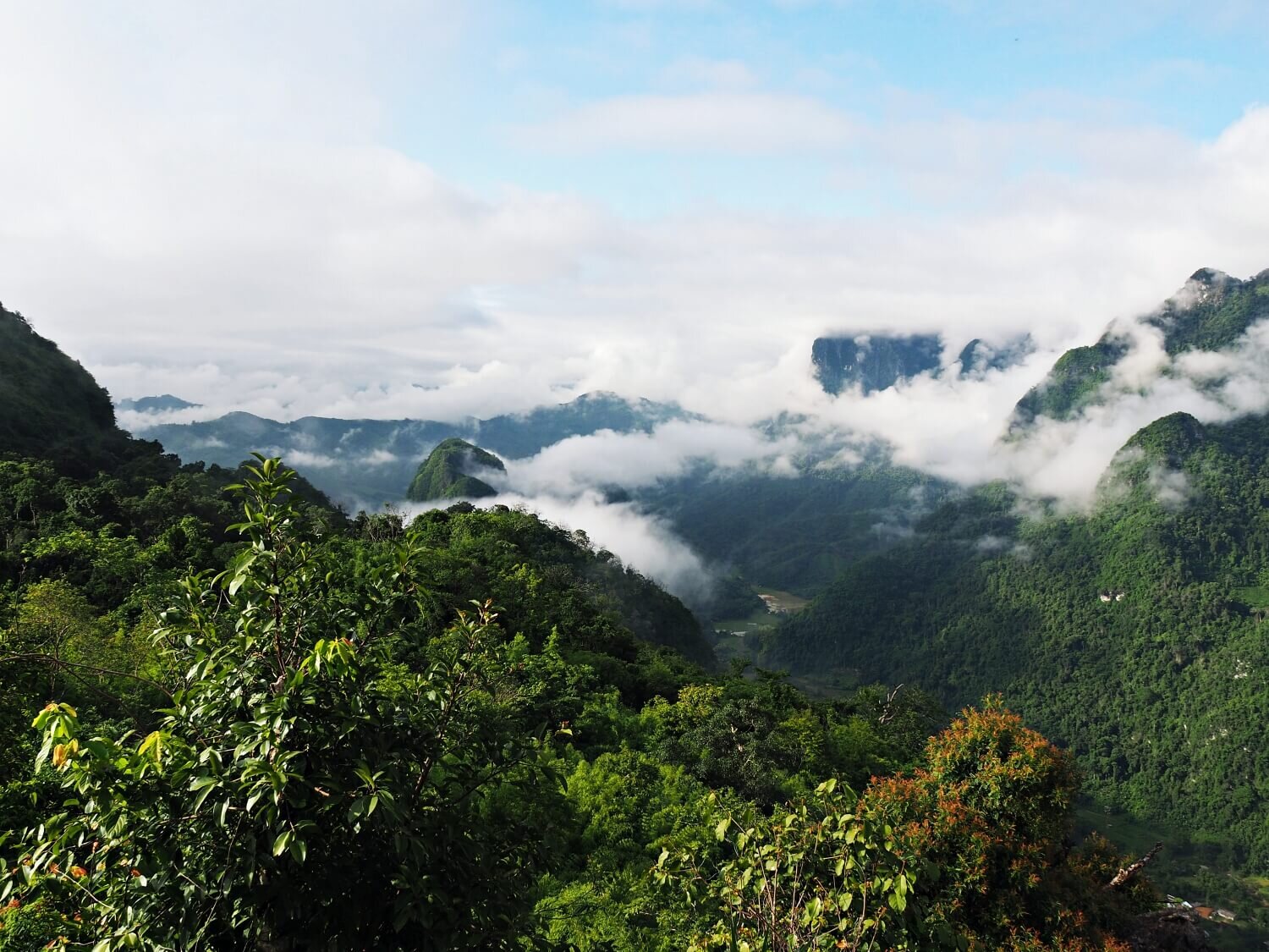
Rising out of the clouds were towering karst limestone mountains and then as we continued to watch, the clouds cleared even further to unveil the Nam Ou river snaking through the valley. To the east, the sunlight had broken through to reveal further peaks carpeted in green trees in the distance. The views in every direction were absolutely stunning and I was so glad that we had been patient enough to wait a mere 45 minutes for this!
We spent a further one and a half hours at the viewpoint, taking photos and simply admiring the incredibly beautiful scenery - it really felt like we were on top of the world!
I might just be a little bit happy here.
The sea of clouds kept sweeping in, obscuring some views just to reveal something else, making the scenery look all the more breathtaking and otherworldly.
Paddy fields in the distance.
We were eventually joined by two other travellers - an American who very kindly took our photo (as we hardly ever get photos together) and a British guy who had timed himself getting to the top and who basically ran past us on the way down - hardcore!
Hiking Pha Daeng Peak was a major highlight of our trip to Laos and one of the best things to do in Nong Khiaw. The scenery is up there as some of the most beautiful we have ever seen. Definitely worth getting up early for!
Did you find this useful? Have you hiked in Laos? What’s the most stunning scenery you have ever seen? Let us know in the comments below!
Looking for more travel inspiration? Click here to discover more of our favourite places around the world.
If you liked this post, Pin it!


